
Published September 29, 2026
A Flood Zone Is Only the Start: Documents Waterfront Buyers Need

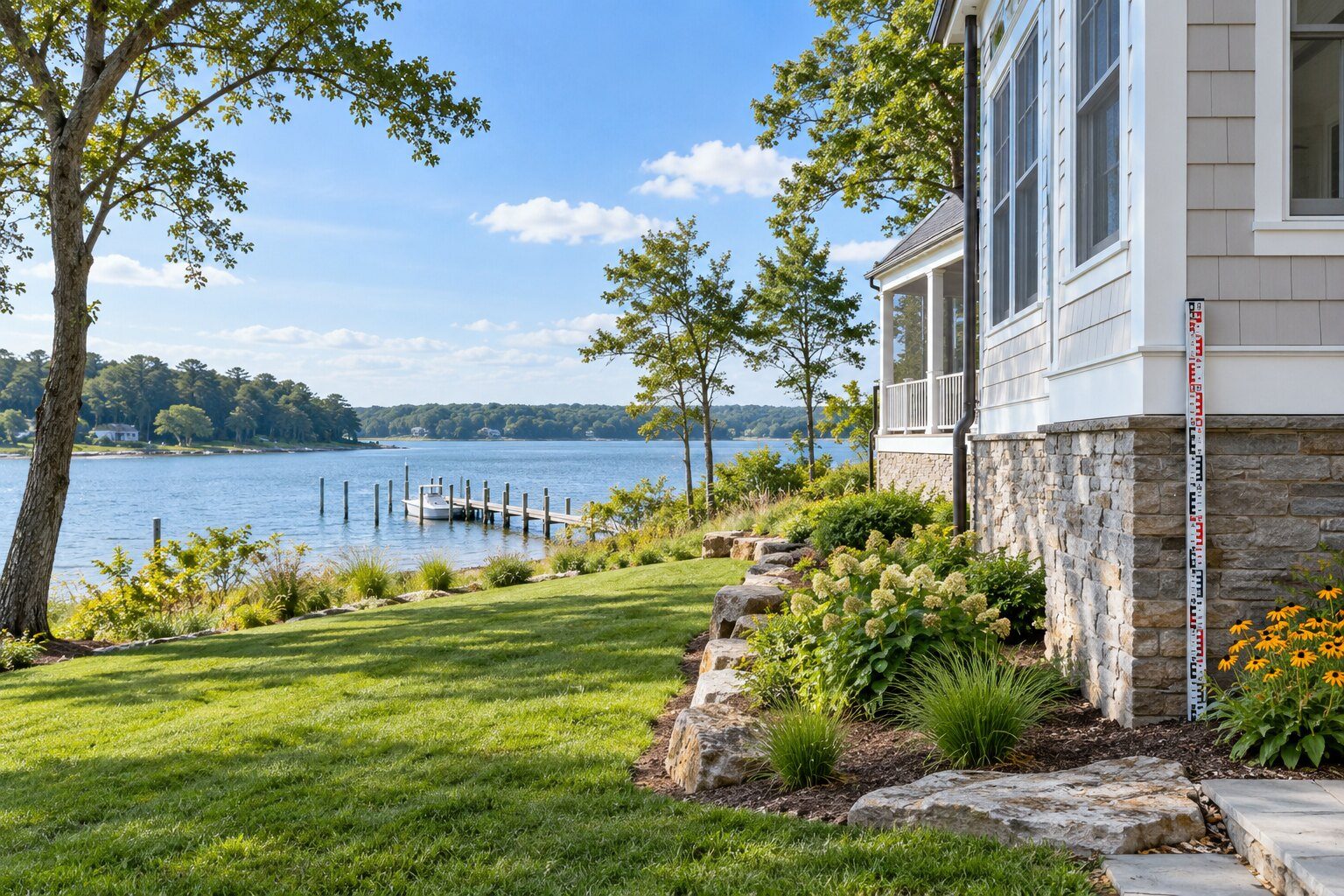
Calvert County provides a Flood Hazard Map and adopted mitigation planning resources, while FEMA maintains the official Map Service Center. Shoreline, tidal, stormwater and drainage conditions may differ within the same community. An elevation certificate may help document building characteristics, but only the insurer may quote coverage and only the lender may state loan requirements.
Start With the Choice the Client Must Make
A flood-zone label is a starting point, not a complete risk or insurance answer. Purchasers should evaluate the effective map, current and future risk information, building elevation, prior claims, mitigation, lender requirements and an actual insurance quote before deciding that a waterfront or low-lying home is affordable. For The Riley Team, the client’s decision sets the research order. We identify the controlling source, then establish when that answer is needed.
Assemble the Evidence Before Discussing Terms
- FEMA Flood Insurance Rate Map panel and official map determination used by the lender
- Elevation certificate, survey or other licensed elevation documentation
- Current flood policy declarations, premium information and any transferable rating data
- Prior flood claims, disaster assistance, substantial-damage or repair records available to the owner
- Permits for elevation, flood vents, enclosures, utilities, additions and shoreline work
- Property-specific flood, wind and homeowners insurance quotes with deductibles and exclusions
One organized file gives everyone the same factual starting point. An item remains unresolved until the responsible source provides it.
Practical Clues Worth Investigating
- The purchaser relies on a owner premium without obtaining a new quote
- An enclosed lower level is marketed as living area without floodplain and permit evaluate
- Mechanical equipment or utilities sit below expected flood elevation
- The map line is treated as a prediction of where water will stop
- A future-risk map, drainage problem or repetitive flooding is ignored because the lender does not require insurance
- The appraisal and insurance files use different building descriptions
Purchaser’s Action Plan
- Search the official FEMA map and County flood tools for the address.
- Ask the insurance producer whether an elevation certificate or additional inspection is needed.
- Obtain quotes for flood, homeowners and wind coverage before financing deadlines.
- Review prior claims and repair permits with appropriate professionals.
- Inspect lower-level enclosures, flood vents, utilities, drainage and shoreline exposure.
- Budget premium, deductible, maintenance and mitigation: not only the mortgage payment.
Owner’s Preparation Plan
- Locate elevation certificates, surveys, flood policies and mitigation records.
- Disclose known flooding and claims accurately under applicable requirements.
- Provide permits for elevation, enclosures, utilities and repair work.
- Avoid guaranteeing future premiums or map status.
- Prepare the home so flood vents, equipment and drainage are accessible for inspection.
- Address inconsistent square footage or room-use descriptions before appraisal.
The Riley Team’s Contract Approach
Dawn keeps map status, physical exposure, insurance and intended use in separate lanes. If the purchaser needs an elevation certificate or quote, the contract calendar must leave time to obtain it. A general credit does not guarantee insurability or a premium. Any repair agreement should identify the permit, professional, completion evidence and effect on settlement.
A Broomes Island purchaser sees an attractive waterfront price and a owner’s existing flood premium. Dawn asks for the elevation certificate, permit file and claims information, then obtains a new purchaser-specific quote. The proposed premium is higher because occupancy and rating assumptions differ. The purchaser updates affordability and negotiates with real numbers before the insurance and financing dates expire.
Questions Southern Maryland Clients Ask
Where may I check the official flood map?
Use FEMA’s Map Service Center and Calvert County’s flood tools. The lender may order its own determination, which controls the lender’s insurance requirement.
When does Zone X mean there is no flood risk?
No. It generally indicates a different mapped level of risk, not zero risk. Local drainage, future conditions and events beyond mapped scenarios may still affect the home or parcel.
How should a purchaser understand an elevation certificate?
It is a standardized record of building and elevation information prepared under applicable requirements. It may support insurance rating, mapping or compliance questions, but it does not itself guarantee a premium or safety.
Will the owner’s flood policy transfer to the purchaser?
Do not assume it will transfer on the same terms. A purchaser should obtain written guidance and a quote from an insurance professional for the new ownership and occupancy.
Does the lender decide whether a home may flood?
No. The lender decides loan and insurance requirements using its flood determination and program rules. Physical risk requires broader mapping, site, engineering and insurance evaluate.
Should a cash purchaser purchase flood insurance?
A cash purchaser may not have a lender mandate, but should still evaluate potential loss, premium, deductible and personal risk tolerance with an insurance producer.
Under what circumstances may finished space below the flood elevation be counted as living area?
Permit, building, appraisal and floodplain rules control. A purchaser should not rely on décor or listing labels; verify lawful use and valuation treatment.
How do prior flood claims affect the sale?
Claims may inform condition, repairs and insurance. Request available records and have the owner, insurer and appropriate professionals explain the home or parcel-specific effect.
Under what circumstances may the flood map change after closing?
Yes. FEMA and communities update maps, and lender or insurance requirements may change. Purchasers should consider both current rules and long-term ownership risk.
What should Dawn calendar first?
The insurance quote, map and elevation-document request should begin early enough that the purchaser still has contract choices if cost, use or financing changes.
Related RileyTeam.net Real Estate Guides
- Is This 1974 Rambler Modular or a Pre-HUD Mobile Home?
- Who Can Sign the Contract When a Maryland Estate Sells a Home?
- Should You Test a Southern Maryland Home for Radon Before Closing?
- Does the Fence Follow the Property Line? A Survey Checklist
- Who Repairs the Road? Private-Lane Questions Before You Buy
- Can This Property Support an Accessory Apartment or Backyard Cottage?
- Is That Heating-Oil Tank Safe, Documented, and Insurable?
- The Appraisal Came In Low: What Evidence Belongs in an ROV?
- Termites, Carpenter Bees, or Old Damage? Read the WDI Report Carefully
For more about Dawn Riley’s experience and negotiation background, visit DawnRiley.net.
Sources Cited
- FEMA Flood Map Service Center
- FEMA, Elevation Certificate resources
- Calvert County, Floodplain Management
- Maryland Department of the Environment, flood maps
General real estate information only. Consult the appropriate legal, lending, tax, insurance, engineering or other licensed professional for the home or parcel.